Photoalbum “Economic forum”
Photoalbum to article “Water Problems of Central Asia”
ECONOMIC FORUM
«European dilemmas: partnership or competition»
Krynica-Zdroj, South Poland. 07-09 September, 2011
Leonid Papyrin,
Member of Expert Council
Of International Agency “FERGANA”
Moscow, Russia
Water Problems of Central Asia
“Water is the most valuable mineral;
Water is not only a mineral raw product,
not only a tool for agriculture development;
Water is an effective conductor of the culture;
It is that alive blood, which creates the life there,
where it was absent».
Academician A.P.Karpinsky,
The First President of the Russian Academy of Sciences
Introduction.
Not once I was openly speaking with criticism about the status of the Rogun hydro-electrical plant (HEP) construction, but the article in the Uzbek newspaper “Truth of the East” has astonished me insomuch that I decided to speak out again. The Chief of the organization that has carried out investigations and prepared the project of Rogun HEP construction Sergey Zhigarev suddenly says that this “brainchild” and “pride” of his Institute presents a large hazard for three republics of the Central Asia. So, it is reasonable to ask him: if it is so, then why did you prepare this project? But if you have already prepared this Project and approved it in a hundred of checking and controlling agencies, then why don’t you say downright that instead of a HEP project you have executed a project of a delayed-action bomb and there is no need to build it. The saying of Sergey Zhigarev can be understood also that the staff of the Tashkent Hydroproject Organization is unable to carry out qualitative investigations and prepare documents for complicated hydrotechnic constructions, which, in general, is close to the truth. And, maybe, this a repentance for the multi-year useless work of the very large number of workers, having spent a good deal of means for investigations and designing. Sergey Zhigarev considers now that the Rogun water storage reservoir will threaten both to Tajikistan, Uzbekistan and Turkmenia. He forgets about Afghanistan. Uzbekistan establishes “National Committee on Large Dams” “…for promoting the Republic’s interests in the sphere of safety of large dams and the position on effective use of trans-boundary water resources”. That is, in principle, the same people who have carried out the investigations and prepared the project of the Rogun “bomb” will estimate their own work, but already from the positions of controllers. In total, the statement of Sergey Zhigarev looks not like the words of an engineering specialist, but like a sponsored publicity-article of a journalist. Why would not one say directly, that due to the lack of financing, the investigations have been carried out in a volume quite insufficient for such a complicated building object and that they do not correspond not only to the present-day requirements, but to the standards of that time as well. The investigators have mistaken twice in the determination of the Vahsh’s hard run-off volume within the dam’s measuring range, which has led to errors in the designing of building tunnels and, in turn, to destruction of them. Why would not one say, that the blocking of the channel by a building bulkhead has been done untimely, when there were neither basic, nor reserve gates in the building tunnels. Why does not one tell about insufficient financing of the investigations and offer apologies for difficulties created for the neighbors, and about tens of other errors, then the today’s builders of the HEP would accepted this statement not like a publicity, but seriously and they would accept such reports in another way.
For the first time I have heard about the problems with the Rogun HEP construction in 1977 or 1978 when the construction of the Nurek HEP was already at the final stage. Unexpectedly to our field team of the Southern Geophysical Expedition PO “Tajikgeologia” a famous hydro-builder has come, whom we were calling, behind his back, warmly and simply as uncle Kostya (Konstantin Vladimirovich Sevenard – Senior). He suggested to us to start out solving some problem at the Nurek HEP Dam – namely to check density and moisture content in the loamy core of the dam with the aid of a penetration logging station. Usually, while heaping and packing loamy material in the dam core, we were taking a monolith (sample) from each 30-40 cm thick layer, wrapped it by paraffin and in laboratory determined its density and moisture. But Konstantin Vladimirovich decided to check, how to measure these parameters in a layer of 20-30 m thick. I was indignant at such a decision saying: “The public press reports that the hydro-electrical plant is almost built, but you want to carry out additional investigations, and then, maybe, can again detect some arrears. So, how many years can be these arrears continued after completion of the construction?” But Konstantin Vladimirovich replied jokingly: “If anybody of you will live to the end of the Rogun HEP construction, you will have to remake and finish the work much longer and in tenfold larger volume – just such a gift was being prepared by our friends-Uzbeks for us”. At that time no any investigations were planned at the Rogun HEP, and I did not pay any attention to this joke. But in 30 years, when I had to examine the materials of the investigations for the Rogun HEP construction, I remembered about it. Moreover, one of the specialists, who worked in Rogun since the beginning of the construction, told me during a resting pause, that Konstantin Vladimirovich repeated the same joke constantly.
Not long ago I wrote a letter to the Director of the Research Center MKWK (?) Professor V.A.Dukhovny. The letter is short, therefore I shall cite it wholly.
================
“Dear Viktor Abramovich,
Today is one hundred years since the date of Lake Sarez formation. In connection with this date I have prepared the website: www.sarez-lake.ru You can easily find it in any searching system, if printing: “Personal website of Leonid Papyrin”. I am convincingly request you personally to read and study my website and then to write your opinion on 2-3 pages. I think that the Sarez catastrophe is by an order of magnitude more dangerous for Uzbekistan than an accident at the Rogun HEP. However, the Rogun HEP is continuously discussed in Uzbekistan, but silence is kept about Lake Sarez.
Sincerely Yours and best regards,
L.P.Papyrin”
====================
The reply.
«Dear Leonid Pavlovich,
Thank you for your message. With pleasure I have looked through your website. I think you have made a unique review of the major part of investigations on Sarez. Many thanks for not having forgotten my teacher V.V.Poplavsky. … … … Our estimates are less frightful than yours, because spreading of the flow highly smoothes the effect, and the maximum excess of water level over the flooding marks within the measuring range of Termez does not exceed 3 m. Further the effect will become more and more lower, which is understandable, as the Amu Darya valley is very outstretched. I consider that the most realistic are your proposals to smooth the Sarez risk by means of intensifying the filtration through clearing cracks-outlets and preventing of colmatage…
Best regards, V.A. Dukhovny”
==========
Debates between Tajik and Uzbek journalists and politicians in the press are occurring continuously during the last 10 years. And they concern only the construction of Rogun HEP, whereas the problem of Lake Sarez and other hazards are kept in silence. Here, the position of the Uzbek information press is very strange. They consider the Vahsh as trans-boundary river and fear an accident at the Rogun HEP, requiring an international expertise (though, what type of expertise should be is not explained). At the same time, the river Bartang (Murgab), which is also the left-hand tributary of the river Amu-Darya (Pianj), is not, by their opinion, somehow a trans-boundary river and they do not fear already any catastrophe at Lake Sarez or an accident at the Sarez HEP. Though, if a Sarez catastrophe will happen, then the damage to the Amu-Darya lower cources will be much higher than from the accident at the Rogun HEP. Somehow an opinion is rife in Uzbekistan that as Lake Sarez is located in Uzbekistan, then just its territory will get the highest damage. But this is quite not so. The zone, affected by mudflows in Tajikistan and Afghanistan, covers only small populated settlements where there are no large enterprises and constructions, unlike Uzbekistan and Turkmenia. And the largest loss of Tajikistan and Afghanistan will lie in that the delivery of drugs will be interrupted for some time. I see some political subtext in the given sub-objectivity, but I would like to answer to the raised question from the purely engineering point of view.
Sarez catastrophe
Let us return to the historical facts. Multi-year discharge of Amu Darya River at the old-created hydro-post Kerki is equal to 2000 m3/sec. Observations at this hydro-post (HP) have been started long ago, far before construction of large irrigation systems and flow-regulatig dams.
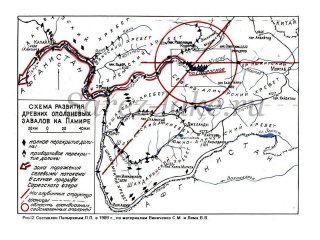
During floods the maximum water discharge in those years reached to 9000 m³/sec. The Amu Darya water flowed over the banks. The river floor is extremely unstable; in the flat part it has very quickly changed its contours in plane. Thus, notable changes of the river floor happened near Kerki Town in 1911. The rather large destruction was brought to the shore in the area of Town Turtkul. This town stood at a few kilometers from the river. During one of the floods the river floor was so strongly deformed, that Amu Darya approached neatly to the town and destructed several blocks of buildings. Due to the threat of destruction, the capital of Kara-Kalpakia was moved to Town Nukus. All this is described in details in the book of A.A.Sokolov “Hydrography of the USSR”, Hydrometeoizdat, Leningrad, 1952.
Now let us look, what will be the prediction (according to the present-day data) after a collapse of the Right-Bank Landslide in volume of 1.25 km³ into Lake Sarez. The overflowing wave over the dam will amount to 100 mln.m³. In 1990 investigations of the expected wave-related regime in Lake Sarez, which can be formed due to a sudden collapse of large rock masses into the lake from the Right-Bank slope, have been carried out by the SANIIRI Institute (Tashkent) and at the Institute of Mechanics of MSU (Moscow). The investigations have been carrying out on both physical (hydraulic) and mathematical models. In all the cases with a landslide of 0.9 km3 the volume of water flowing over the dam (without destruction of the latter) amounted to 100 mln.m3. In 1998 a military corps of engineers of USA has conducted the similar modeling and obtained the same volume of overflowing water at the landslide size of 0.9 km3. Additionally they calculated the time of wave movement to the basic populated settlements and wave height above the river level. Thus, three different organizations, modeling the water overflowing process by different methods, have obtained approximately the same result of overflowing water volume. Inspite of the fact that by seismic data the landslide size was 1.25 km3, I decided, for simplification of complicated calculations, to stop on the American variant of movement of the first mud flowing wave, which will appear due to water flow over the dam. Further details can be found at website: http://sarez-lake.ru/monograph/chapter7. In four days the additional water discharge will be in the area of Termez 17708 m³/sec, and the wave height over the river level – 5 m. The same additional water discharge will be at HP Kerki. At the same time, A.A.Sokolov noted that with the discharge of 2000 m³/sec at HP Kerki, only 2000 m³/sec of this amount reach the Aral Sea, the rest is absorbed by sandy rocks. During movement of the flood wave with a discharge of 20000-25000 m³/sec, 5000-6000 m³/sec of it will be absorbed by rocks, which will cause a rise of salt waters over a large territory.
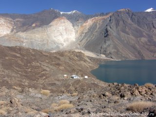
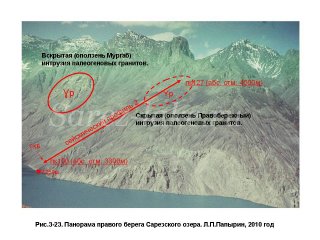
Simultaneously with the first wave of mudflow flood, in the area, where River Bartang inflows into Pianj River, a mudflow slide dam will appear, which will create a temporary lake on Pianj River. To predict the height of the dam is difficult, the cases are known when on large rivers the size of mudflow dams has reached one billion m³. One of such historically known catastrophic events is the outbreak of the seismogenic mudflow dam on the river Dadu in Sichuan Province in China (1786). In 10 days after formation of the dam, the latter destructed and a powerful flood distributed downwards the valley to a distance of 1400 km, having killed 100 ths. people. But I suppose that the maximum size of this dam will be 25-30 mln.m³.
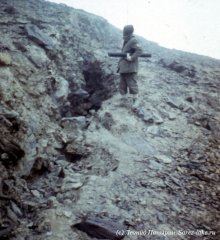
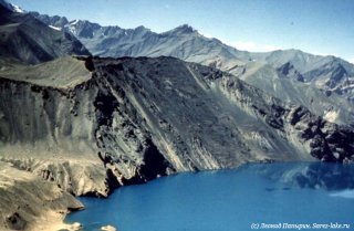
By our estimates, the height of the dam will be within 60-220 m. The higher is the dam, the larger will be the volume of the lake and the longer it will be being filled with water till appearance of a breakthrough wave. The second mud-flowing wave may come to Termez in 12-80 days. Its additional volume will vary within 25500-119000 m³/sec, and the height over the river level – 7-60 m.
The same water discharge will occur at HP Kerki and below it in the valley of Amu Darya River. The second flood in the Amu Darya lower course will be more destructive. And if during floods in the beginning of the past century the maximum displacements of the river floor have amounted to the first kilometers, then during the given flood they may reach ten and more kilometers. At the maximum height of dammed mudflow, there will be flooded and ruined the town Khorog. It is quite probable that the town agglomerations of Termez, Charjou and Nukus will be destructed too.
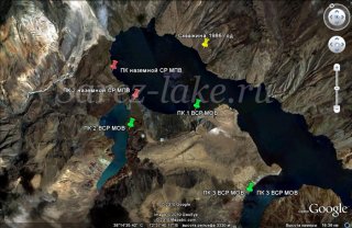
The third mudflow wave will be caused by a formed pass through the Usoi Dam. It will reach the town Termez in 120-306 days after beginning of the catastrophe; additional water discharge will vary within 30000 – 74100 m³/sec; water level in the river will rise by 9 to 40 m. Additional water discharge in the area of the hydro-post Kerki and further in the Amu Darya valley will also within 30000 – 74100 m³/sec.
Sarez catastrophe will destruct the highway “Dushanbe-Khorog” (namely, in the area where it runs along the Pianj River shore). All the bridges over Pianj and Amu Darya will be either demolished or, because of displacement of the river floor, will become needless. Under destruction will be the hydromeliorative constructions in Uzbekistan and Turkmenia, including also the Kara Kum canal and populated settlements on its shores.
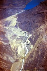 The railway transportation between three republics will be interrupted. It would be reasonable to start the recovery works only after the third flooding, this is – not earlier than in a year after the catastrophe beginning. In the hazardous zone, affected by mud flows, 5-6 mln.people live who can stay houseless. The number of victims will amount to 10% of the above quantity. So, such are the expected consequences of the Sarez catastrophe. More detailed information about it can be found on the website: «www.sarez-lake.ru».
The problems of the Rogun HEP construction
Now, speak about the Rogun HEP. In 2005-2007 I have studied in details the materials of the engineering-geological investigations for substantiation of the construction of Rogun hydro-electrical plant. The investigations were carried out in 1968-1978.
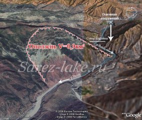
It is a very short time term for such a complicated and enormous work. If to estimate these investigations according to the acting (at that time) standards and instructions, many problems were not solved because of not having enough time. A puzzle is caused by actually complete absence of on-surface geophysical works, which means that the geological mapping and studying of slide processes have being carried out without ahead-performing geophysical investigations in contempt of the Instructions and Statutes acting already at that time. It is not understandable why borehole penetration logging and inclinometric measurements (determinations of borehole curving) have not been carried out and how the geological cross-sections to a depth of 600-800 m were constructed without taking into consideration this parameter. There was not performed the mapping of salt sediments, etc.
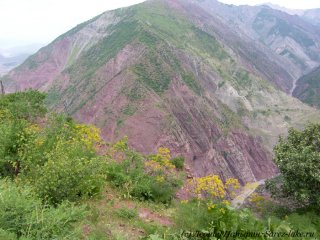
It is reported in the text about the calculation of stability of the basic landslides, but it is not indicated what materials were used as the basis for this calculation and who performed it. The attempts to find these materials in the archive of the Rogun HEP had no success.
Just at 60 km from Rogun, the Southern Geophysical Expedition (SGE) of PO “Tajikgeologia” was located, which could do these and many other kinds of geophysical works. SGE was affiliated to the Ministry of Geology (MinGeo) of the USSR. The MinGeo had its own plants on manufacturing geophysical equipment and supplied its organizations with it much better than design-surveying institutions. I remember how Boris Gelman, who was at that time the Head of Geophysics Department of SAO Hydroproject, has come to me from Rogun with a request to give him a piece of wire, eleсtro-prospecting coil or electrodes, or a few seismic receivers. The Southern Geophysical Expedition had no any problems with availability of such small details at that time. The equipment, which was available in the Department, was also old, which we had not used already for a long time. In 2005 I met already with another Head of the Geophysics Department of Tashkent Hydroproject – Eldar Madghazin and asked him what seismo-prospecting equipment his Department has. He answered: “We have a Hungarian seismic station ISN-24, but do not have any electronic accumulative devices”. Our Expedition has refused to use this station already in 1985. But all these are only emotions of a former worker of SGE. These details before my work at Rogun HEP were not known to me and it never entered my head that suchlike could be. Nevertheless, many problems can be immediately solved with the aid of geophysical method just now, if to follow the Law of the Russian Federation “On Safety of Hydrotechnic Constructions” from July 21, 1997 and “Prescript on Declaration of Safety of Hydrotechnic Constructions” (approved by the Decree of the Government of the Russian Federation No.1320 from October 16, 1997). In Tajikistan the preparation of them is only on the stage of planning.
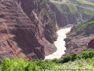
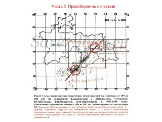
The top-priority problem for the Rogun HEP is to study the seismicity and salt sediments. No any investigations of the deep structure with the aid of abyssal geophysical methods were carried out. A great part of seismic data are of 20-25 years ago. They were obtained by means of outdated analog seismic stations within a sparse network which provides determinations of the coordinates of seismically hazardous nodes with an error of 20-25 km. To treat the data of these stations with the aid of up-to-date computer technologies is difficult.
In accordance with the new requirements, the calculated parameters for high dams are to be determined for two levels of dynamic influences: maximum calculated earthquake (MCE) and projected earthquake (PE). Already at the stage of projecting objects of Classes I and II, it is required to perform the complete complex of geologic-tectonic, geodetic, engineering-geological, instrumental seismological and geophysical investigations at different-scaled levels.
The Rogun HEP dam belongs to especially hazardous objects and is unique by its height (280-335 m), which considerably exceeds the height of dams of Class I (100 m). Therefore, at the building site the determination of initial seismicity, calculation of parameters of seismic influences, seismic zoning and microseismic zoning should be done using data of instrumental seismological observations. Parallel to this one should perform the complete complex of different-scaled geologic-tectonic, engineering-geological and geophysical investigations.
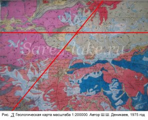
Seismic zoning and studying of the deep structure of the area in the radius of 50 km from the HEP dam (the area size is 100 x 100 km) should be done on the scale of 1:200000 on the basis of the studied deep structure. The method of studying is MEEW (method of exchangeable earthquake waves). While in ordinary seismic surveying the explosions or oscillators are used to excite elastic fluctuations, in this case one uses energy of weak earthquakes. Even in the regions with very low seismicity this method enables obtaining of detailed cross-sections and tomographic sections to a large depth. On the territory of Tajikistan and especially of Pamir, where weak seismic shocks are registered every day, this method can be used for studying the deep structure in mountainous areas of very difficult access with the use of modern portable autonomous digital seismological stations of PSS type “Delta-Geon” (Russia) and deep electric sounding MTZ-AudiMTZ with the stations of FENIX type (Canada). Amount of works: 3-4 profiles of the structures, oriented across their strikes, with a sounding depth of to 25-40 km. It is necessary, jointly with obtained data, to perform processing of the available gravimetric and aeromagnetic surveying data on the scale of 1:200000. By the results of these works, there will be carried out the tracing of the regional tectonic disturbances (including the Vahsh overthrust – the basic seismogenic structure in the area of the Rogun HEP) along the cover of the Hercynian crystalline basement with differentiation of the cross-section into stages (over-salt and under-salt stages). By doing this the position of dangerous seismic nodes will be determined with an error of 1-2 km. A three-dimensional mathematical seismic-tectonic model is obtained on the scale of 1:200000 in the form of different-depth tomographic sections and cross-sections (according to distribution of the geoelectric and speed parameters) with lineation of rupture planes and geological heterogeneities, including accumulations of salt sediments.
Seismic micro-zoning on the scale of 1:2000-5000 should be performed also with the use of modern digital seismological stations of RSS “Delta-Geon” (Russia)
 on the territory of basic constructions, while seismological investigations should be added with detailed areal engineering electro- and seismo-exploratotory investigations, helium surveying and radio-transellumination, the available geological data on wells and adits. The above-listed investigations will give the possibility:
– to reveal or verify the position of seismically active faults of the second, third and fourth orders;
- instrumentally to confirm the monolith state of the basic geological block and to study its seismic regime (it should be noted that presently the seismic micro-zoning is performed to select locations for villas of oligarches, while in this case of building of the unique dam the monolith state of the geological block is determined by guess-work affirming that this a well-chosen place for the basic constructions of the hydro-electrical plant);
– to check the presence of pillars under each large element of a hydro-node;
– to study in details the position of salt sediments in plane and section;
– to assess seismic conditions of rocks, to reveal areas with higher and lower seismic intensity by means of engineering seismic surveying along longitudinal and lateral waves;
– to construct a scheme of seismic micro-zoning on the scale of 1:2000 and three-dimensional model of the area of basic constructions, which will enable obtaining of sections to different depths and cross-sections with different orientation of calculated profiles.
For improvement of reliability and quality of seismic zoning and micro-zoning the investigations should be carried out within short time periods (2-3 months for each step) with the use of a large number of seismological stations “Lelta-Geon” (100 to 150 stations). Only that organization can fulfill such works, which has a large experience of similar works and possesses the sufficient amount of registers.
Seismological monitoring should be started immediately after completion of works on seismic zoning and seismic micro-zoning. For this purpose in the area of building a constantly functioning geodynamic polygon (site) – i.e. a local network of seismic stations PSS “Delta-Geon” (analogous to the Soviet-American geodynamic polygon during building of the Nurek HEP at a higher up-to-date level) should be created. After the filling of the storage basin with water will begin, then there is a possibility to add the local network with on-floor seismological stations of “Sadko” type. During the building and filling of the water storage basin it necessary to perform, alongside with seismological, also all the other types of monitoring, stipulated in the “Prescript on Declaration of Safety of Hydrotechnic Constructions”. The seismological monitoring will make it possible to solve the following tasks:
– determination of spatial-temporal distribution of local background seismicity prior to building of large constructions and filling of the storage basin;
– observation over appearance of an induced (dam-produced) seismicity in the process of water storage filling;
– obtaining of initial data for assessment of risks: seismic, anthropogenic, insurance.
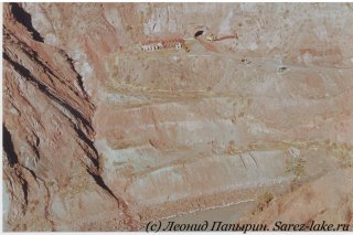
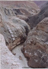
The next hazard is a landslide in volume of 0.9 km3 in the lower water courses of the Rogun HEP. It is reported in the materials of the Tashkent “Hydroproject” Organization (Volume 3 “Engineering-geological conditions”) that the landslide is fail-safe; possible are displacements of slides of the second generation, amounting to the first hundreds of thousands m3. The authors of the latter source consider, probably, that the sliding slope was already subjected to displacement; the very upper part of the ancient landslide reached the river Vahsh and was washed out, and the middle part in the form of a reverted core of the Kirbicher synclinal took a stable position and, thus, would not displace. But this conclusion was based on suppositions according to the visual observations, i.e. this is a hypothesis. In accordance with the both old and new requirements, the slopes adjacent to the dam should be comprehensively investigated, making calculations of the slope stability for seismic actions of different intensity.
 Therefore, the investigations are extremely necessary. There is a great probability that this supposition will be true. But if to believe to the single obtained cross-section, then the amount of secondary landslides on this slope can reach from the first hundreds of thousands to the first millions of cubic meters. Collapse of landslides of the second generation will lead to blockage of the Vahsh river channel and formation of dams with a height of 40 to 80 meters. The same conclusions were made by specialists of the engineering company Lahmeyer International, i.e. collapse of secondary landslides will cause a threat of HEP underflooding.
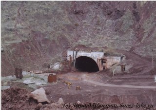
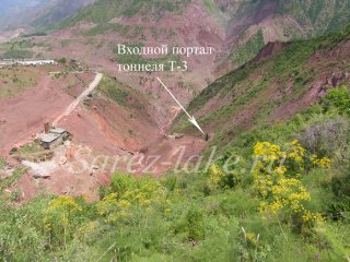
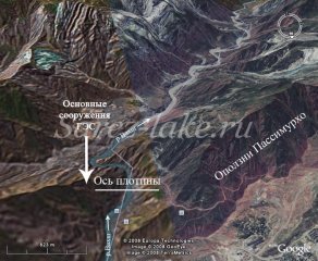
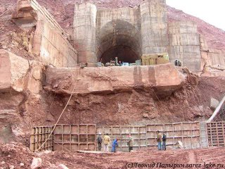
At the present time the access to the tunnels and basic underground constructions of the HEP is implemented through the transport tunnel T-3. When filling of the water storage will begin, the tunnel will be closed and transportation of all the materials to the dam will be done by the special road from the side of the upper water along the sai (gully) Passimurkho. The road runs along the slide slope. With water level rise in the water storage basin the sliding processes will become active, destroy the road and stop the building works. No any investigations and calculations of stability of the Passimurkho slopes were carried out. There is a proposal to dig additional transport tunnels in this area, but neither investigations were performed for their construction and, furthermore, neither calculations of the slope stability were done.
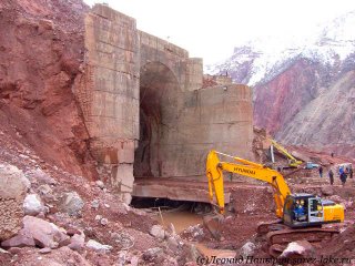
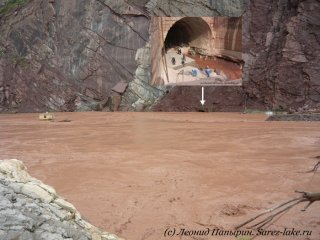
In the close proximity to the dam’s hydro-post the mud channel Obishur inflows from the left-hand shore to Vahsh. Once each 10-11 years it dams up the river Vahsh. Last time it happened on May 19, 2009. The mudflow sediments in the Vahsh channel amounted to 300 ths. M³ and they caused a water rise within the building site by 6 m. The auxiliary building tunnel was completely flooded. Only due to lucky fortuity (there was a shift of workers and nobody was present in the tunnel) it was managed to avoid victims.
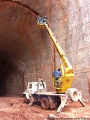
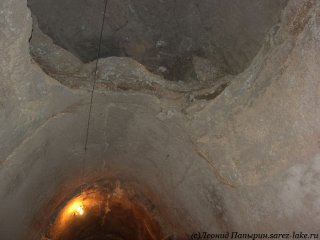
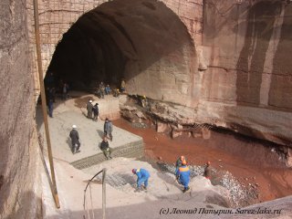
In December 2008 and February 2009 I participated in the geophysical works in the auxiliary tunnel. At that time, besides our team of 10 persons, 100 workers were working there at repairs of the exit portal, small-sectioned tunneling through the slide dam. And if it were not for the good fortune, the number of victims would be more than with the accident at the Sayano-Shushenskaya HEP. A flooding was starting up, and the water discharge in the river Vahsh was equal at that time to 1500 m³/sec. Even for such a powerful river (with the high velocity of water movement) as Vahsh much time was required (a month and a half) in order to wash out the mud plug. Here, to accelerate washing out one had to do mudrushes through it by means of explosions.
Of an interest is another moment. The first mud flow blocked the Vahsh channel not fully, but the next second flow increased the height of the slide dam. If intensive rains would create conditions for formation of the third mud flow, then this height could be much higher. By calculations of the hydrologists, the maximum single mud outburst can reach 3 mln.m³. Such amount of mud outburst will lead to a serious accident at the plant. According to the old Hydro-Project of SAO it is planned to build a 100 m protective dam, a water spill tunnel of 25 m² in diameter and 800 m in length, and a tunnel with a diameter of 40 m² and a length of 300 m for water diversion from River Ob-Shur in the area of its mouth. But are these measures sufficient to provide the safety? Most likely that a necessity will appear with time to increase the height of the protective dam.
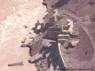
Dr. V.F.Ilyushin in his article “The lessons of the accident in the building tunnel while the Rogun Hydro-Complex construction” (Journal “Hydrotechnic Engineering”, No.4, 2002) reports that the building tunnel of the first stage in 1990-1992 has completely got out of order and analyzes in details the reasons why it has happened. In total, the author considers that chronically insufficient financing has led to low quality of building and research works and became the basic reason of the accident in 1992. The researchers made a twofold mistake in determination of the amount of rock flow of River Vahsh. It should be noted that the accident happened without any influence of outside natural factors (e.g. earthquakes, floods). The building tunnel of the first stage got out of order per se. In 1993 a strong flood has ruined the second tunnel and the cofferdam diverting water from the River Vahsh to building tunnels.
It can be supposed that the rest blocks of HEP are in emergency state also for the same reason. The building works were stopped without any conservation of the constructions. Thus, detailed investigations are needed to carry out using the up-to-date equipment and devices and only then to start preparing a new Feasibility Study. A dozen of actual engineering-geological problems can be mentioned more (salt protection, stability of shores, rock block slides in the basin of River Surkhob being in the zone of the water storage reservoir, etc.), which should be investigated prior to preparing of a working project. The major part of additional investigations should be performed during a year and half or two years. After that one can speak about a Feasibility Study, final project and optimal parameters of HEP. In 1983-1985 we have managed to implement the unique seismo-prospecting works on the Right-Bank Landslide Slope of Lake Sarez. The upper slope steepness reached 30-35°, the vertical excess of the upper observing pickets above the lake reached 1200 m. To carry out these works became possible only thanks to appearance of portable digital seismic stations SNC-1 and Talgar-3. But as the first station had only one seismic channel and the latter – 3 channels, the measuring productivity was very low. In the early 1990s several types of 24-channel portable digital accumulating stations appeared in Moscow. In 1999 our Department got two 24-channel portable seismic stations Lakkolit-24M produced by the Company “Geotech”. The station consists of separate blocks. Simultaneously, “Geotech” produces auxiliary devices and equipment, seismic “braids” (cable with sensors) and extension cords made of thin 48-wire cable, seismic receivers for registration of longitudinal and transverse waves were produced by an American technology. I put a goal before myself – to develop such a type of a station with 2 or 4 registers (i.e. 48 or 96 seismic channels), which could make possible to carry out seismic investigations in mountainous conditions similar to the Right-Bank Landslide on Lake Sarez and to conduct measurements by any seismic methods to depths of 350-400 m, with both percussion and explosion sources of elastic oscillations. Here, I took advise of experienced operators and equipment developers. In the end of 2005 a Russian engineeing company began preparing an application for different devices and equipment for 2006. I have convinced our Administration to order a station with two registers and one complete set of auxiliary devices with a hope to buy with time two registers more, and then the station would be 96-channel one. In this case I guaranteed to the Administration that this seismic station will enable us to study any Rogun landslide and any Rogun slope. And if somewhen we shall purchase special seismic probes, produced by an Amerian technology, then we shall be able to conduct seismic transillumination between wells and outworkings. The seismic equipment was produced, delivered to Rogun, adjusted and tested. The eaquipment was attached with a package of processing programs. In November 2006 the seismic station was ready for operation. But at that time Barki Tajik declared at first about interruption of the works and later about cancel of the agreement on the Rogun HEP construction. In the beginning of 2007 I had to leave Rogun. I handed the equipment according to the Protocol, where one coupled 48-channel seismic station was clearly indicated. The Administration did not want to carry the equipment to Russia and again to solve problems with the customs. But there was no purchaser in Tajikistan, who would understand what was the equipment intending for. Though some organizations did not have any seismic stations. As the set included two registers, so they thought that these were two stations. The equipment was divided into two parts and sold to two different organizations. But when in these organizations the people appeared who tried to work with this equipment, it became clear at once that without additional devices these two registers can not operate for any purposes. It was lucky that I was not allowed to buy four registers at that time.
